


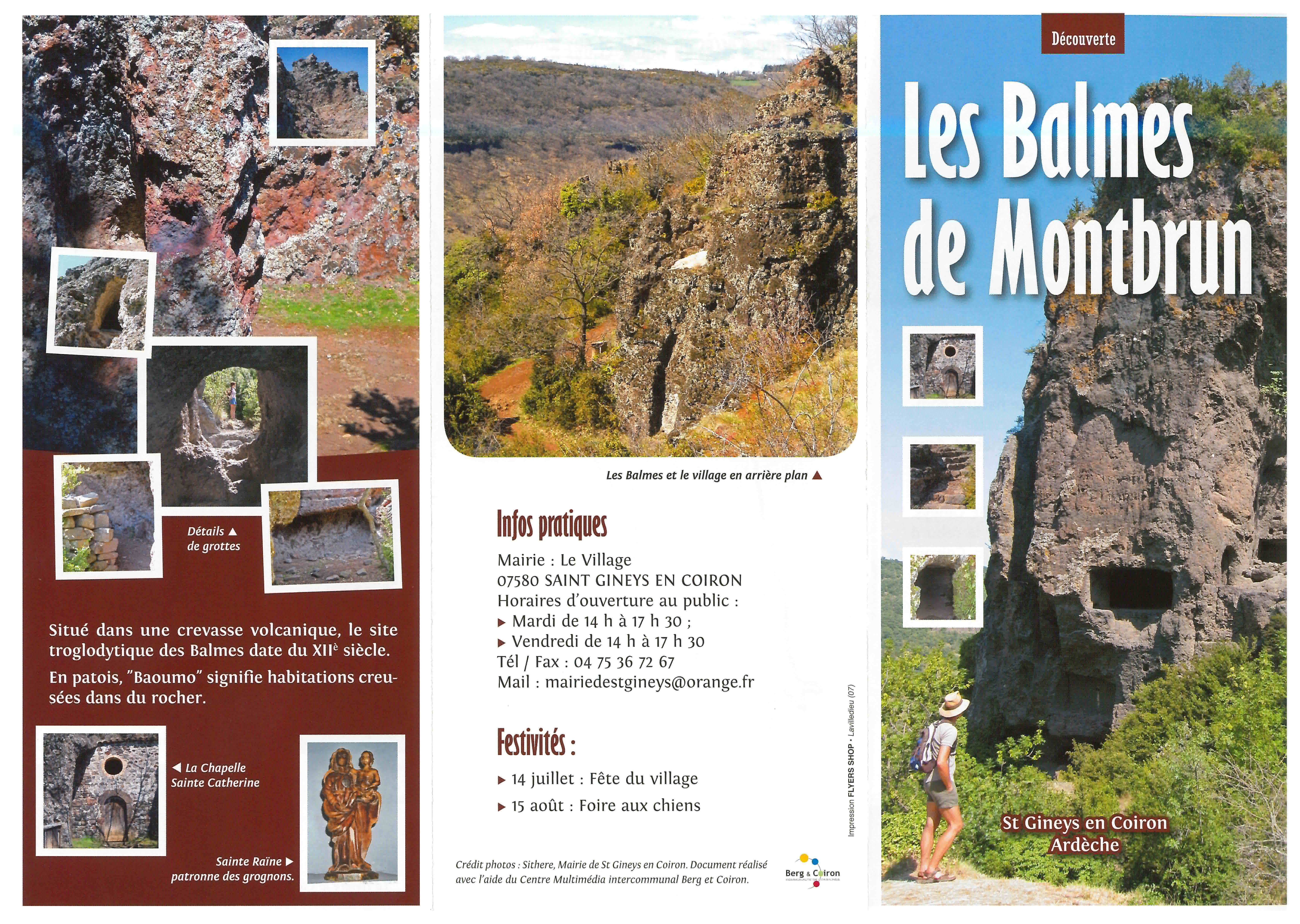
Balmes de Montbrun
Photos
Information
Description
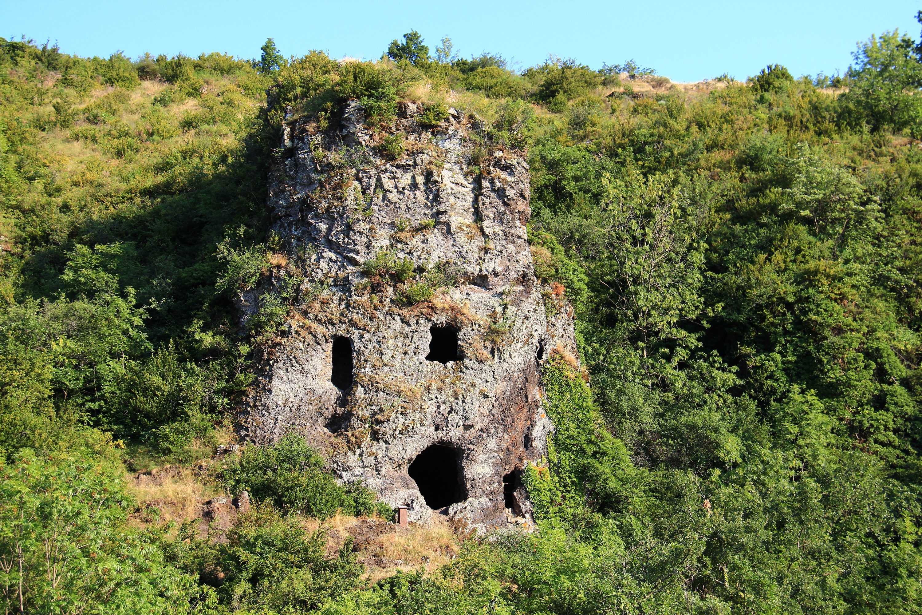
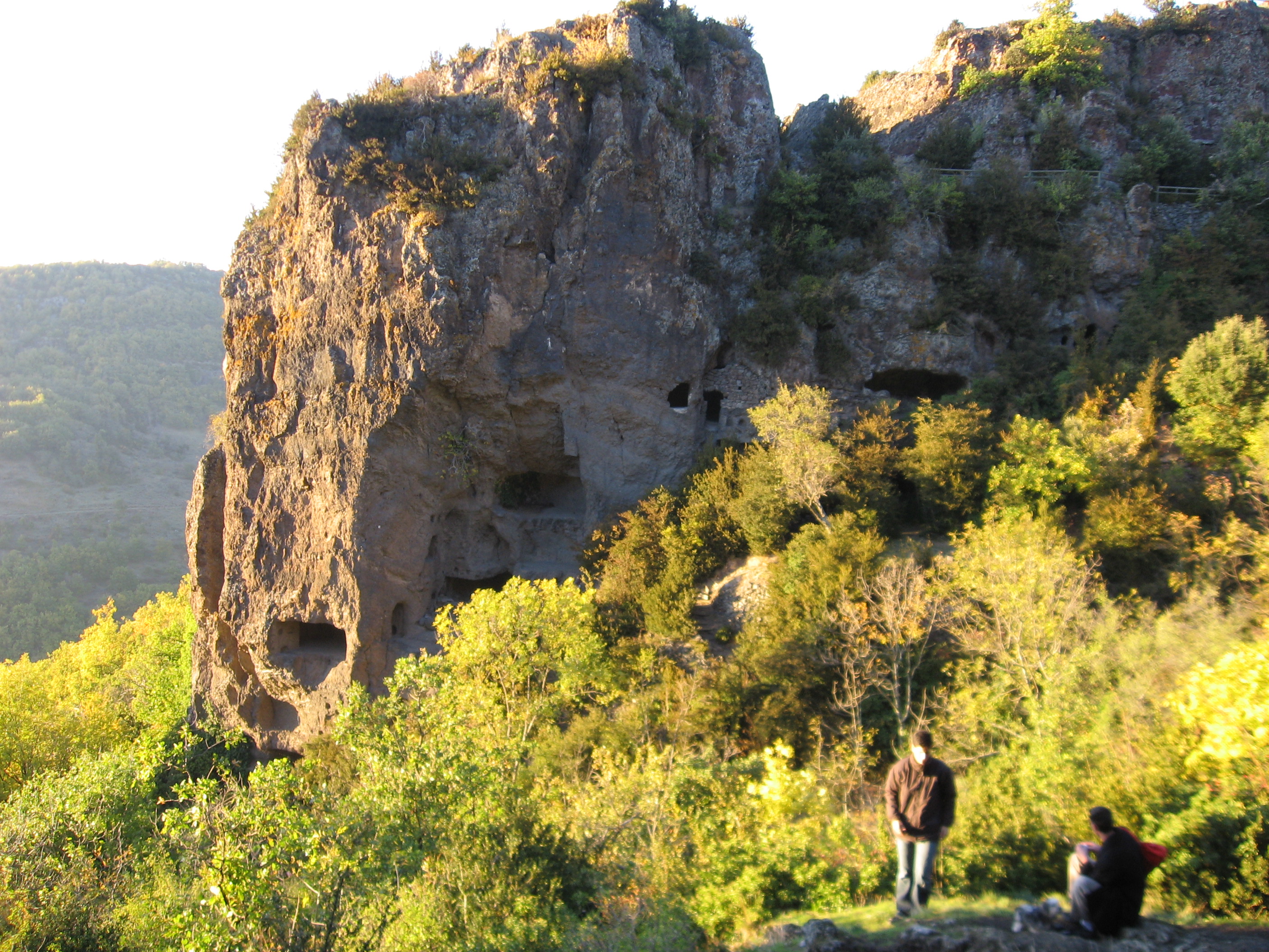
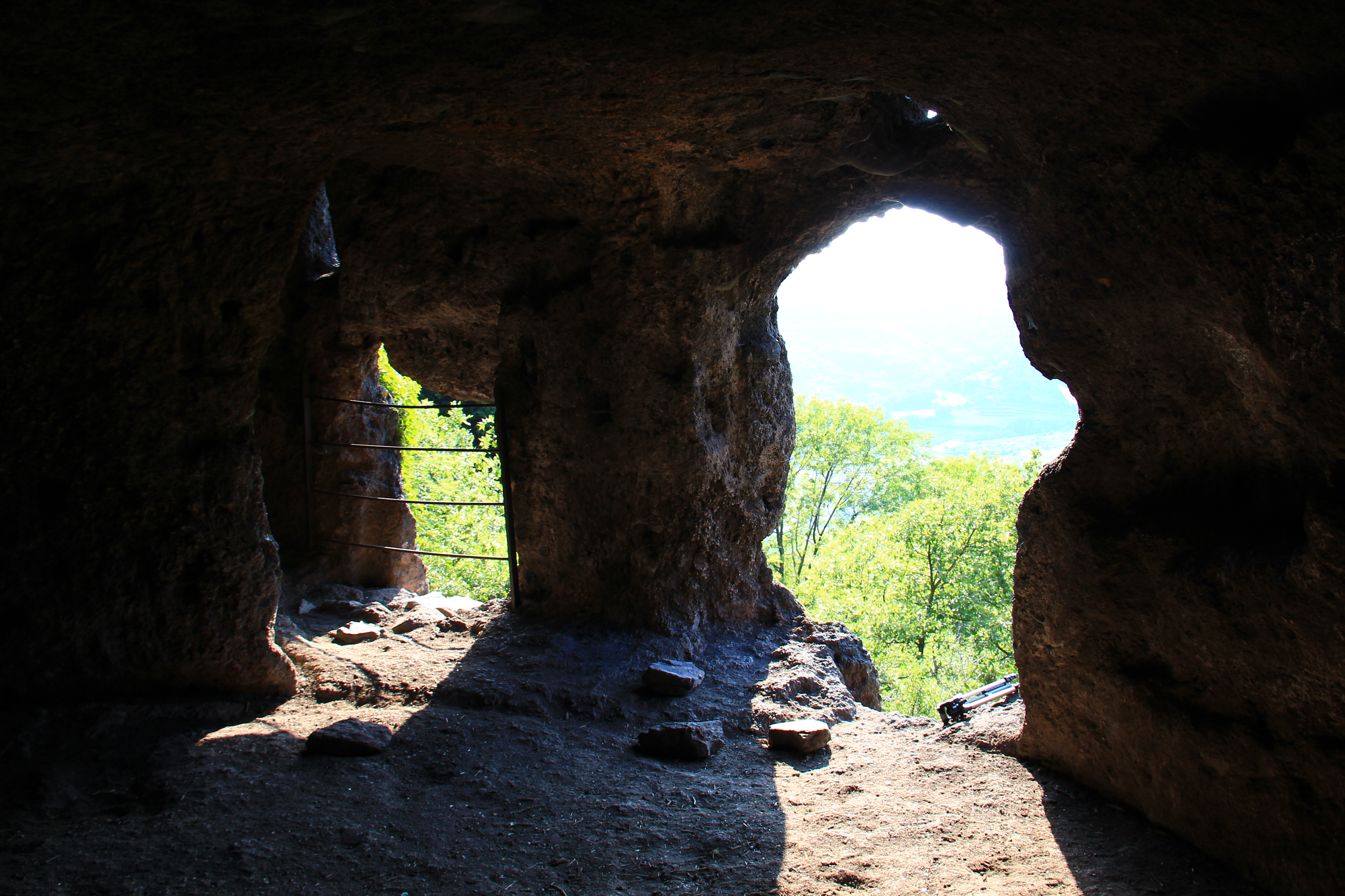
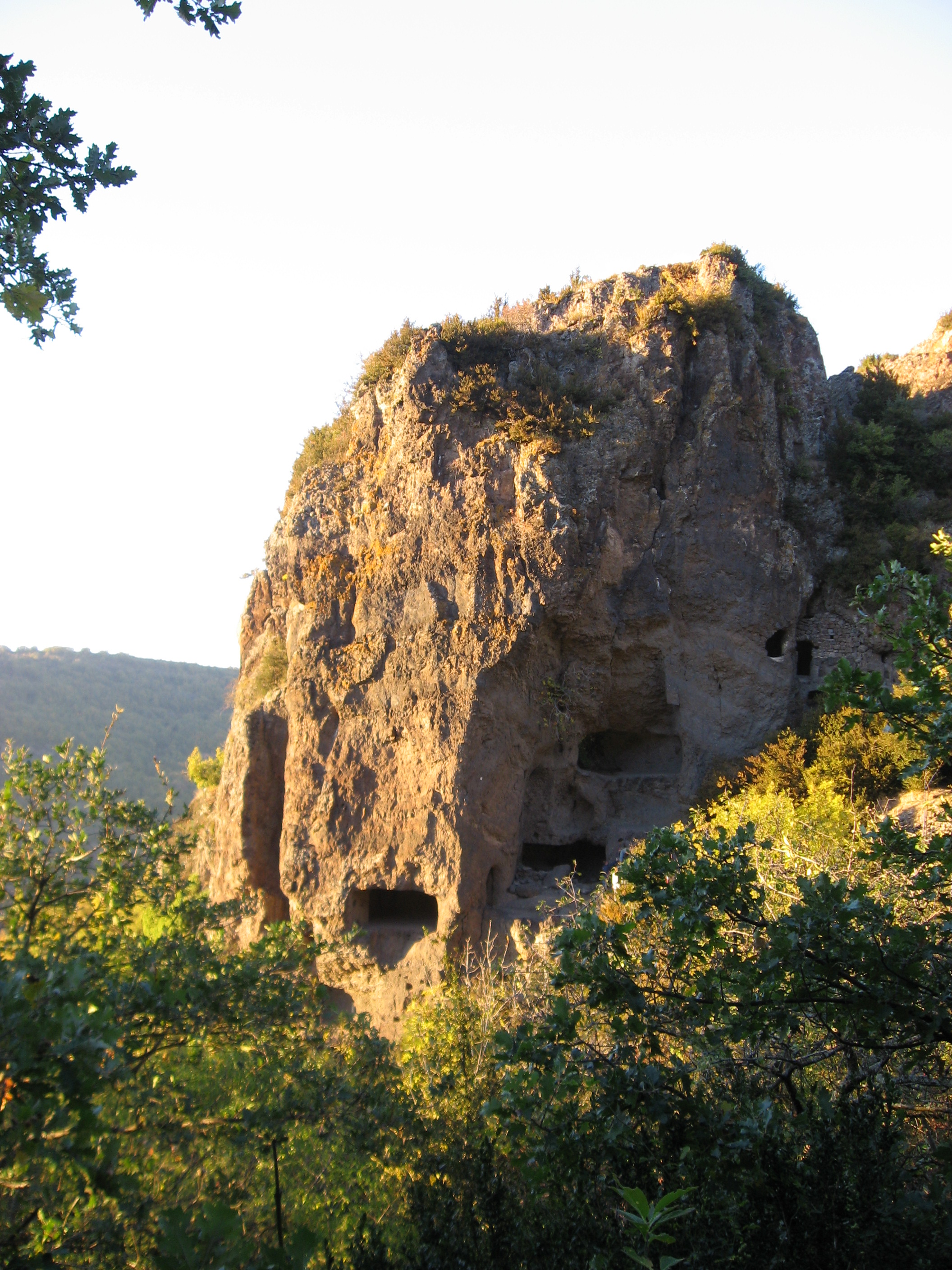
Traces of the modifications made to these caves are still visible: beam and staircase anchors, niches, skylights, gutters, grooves, and benches.
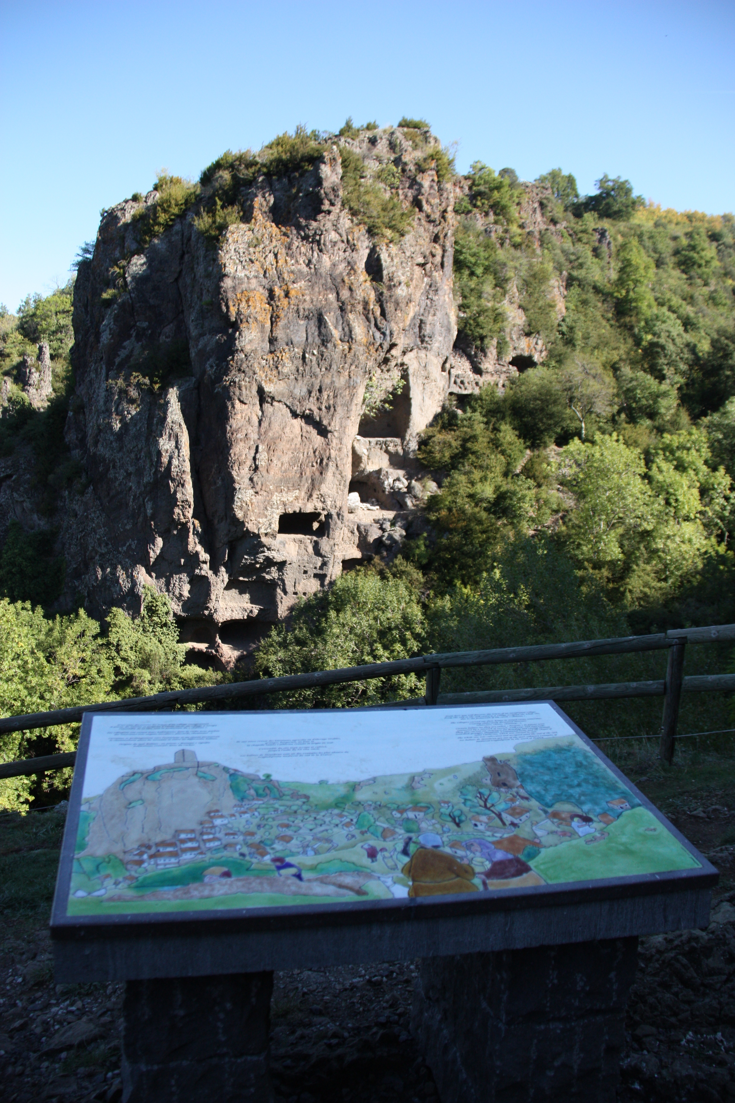
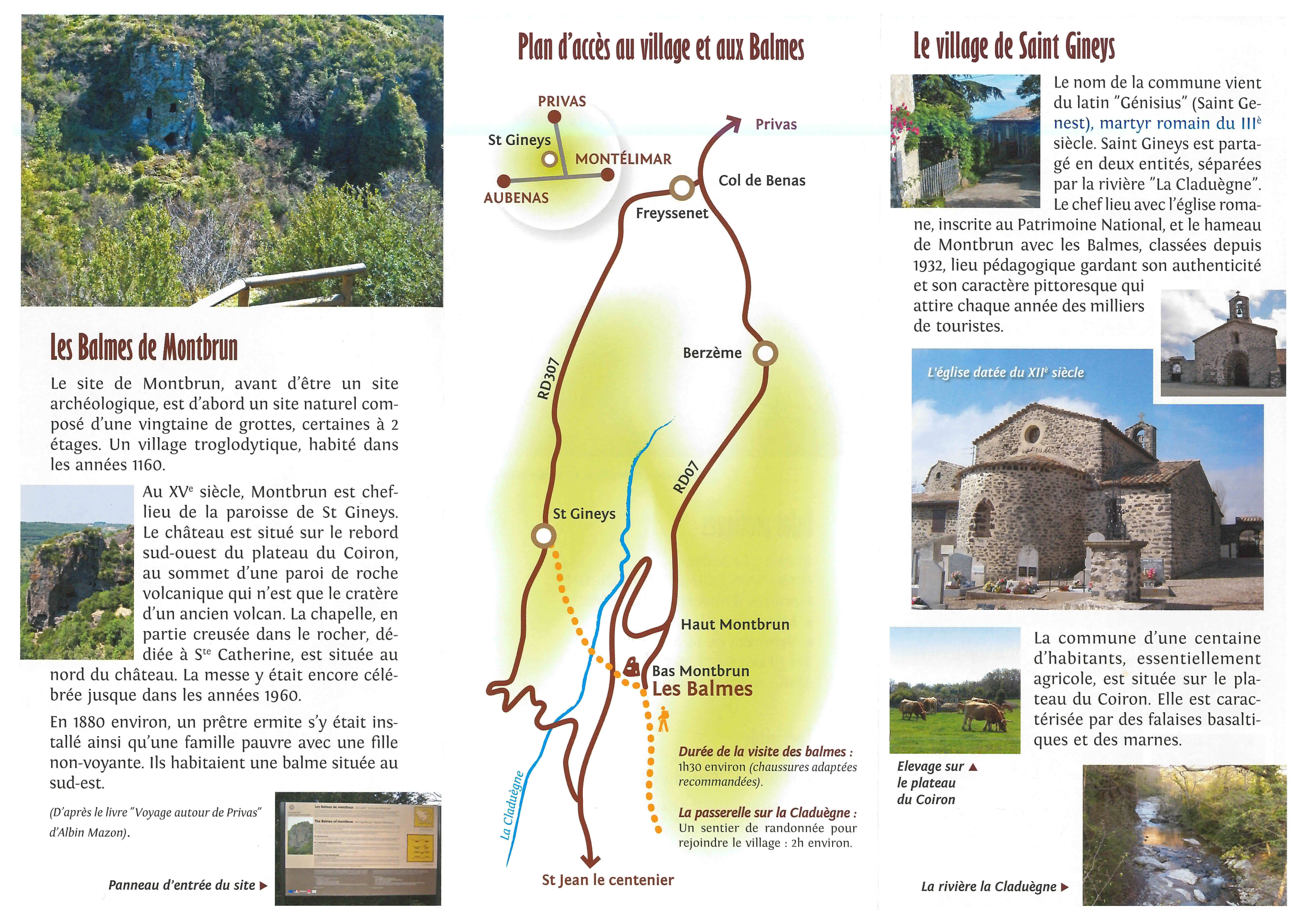
A path, still partially paved in places, served this village, founded around 1210.
It had a chapel (Saint Catherine’s Chapel, which is still maintained), located north of the castle and also partly carved into the rock.
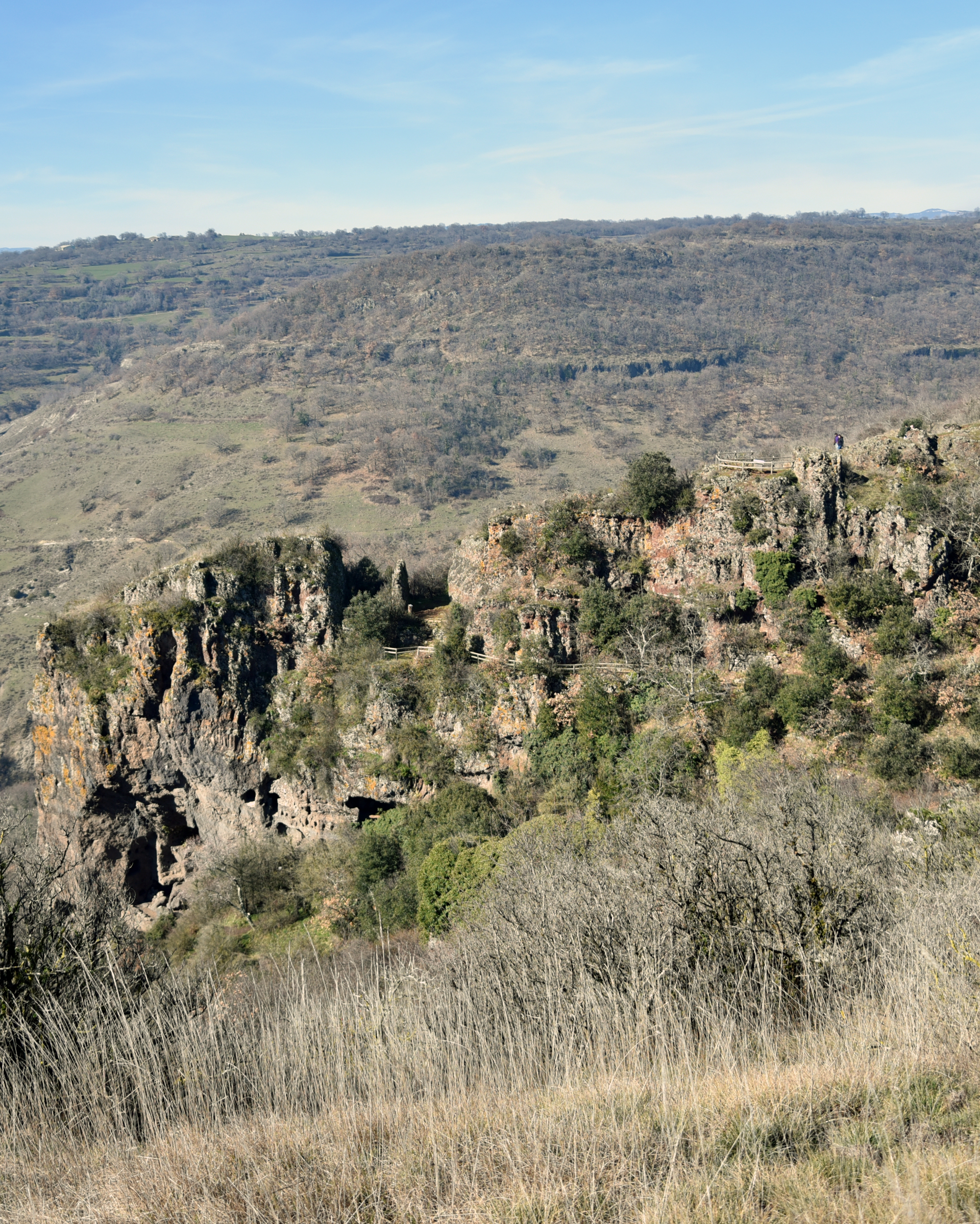
This medieval village had some fifty dwellings carved into the cliff of the crater of this extinct volcano; half of these dwellings are still visible and can be explored!
The last inhabitants lived in the village around 1880—a hermit and a poor family, in a sheltered alcove on the southeast side of the cliff.
The site has been inhabited for millennia; an oppidum (fortified settlement) existed across the valley, in Cheylard, in the 5th century.
We also propose:
- Eglise de Saint-Gineys-en-Coiron
- Statue de Sainte-Raône
- Village de Saint-Gineys-en-Coiron
- Aire de pique-nique à Saint Gineis en Coiron village
- Aire de pique-nique du village de Saint Jean le Centenier
- Circuit "De St Gineys en Coiron aux Balmes de Montbrun"
- Circuit "De St Jean le Centenier aux Balmes de Montbrun"
Coordinates
- Adress07580 Saint-Gineis-en-Coiron
- Contact04 75 94 89 28
04 75 36 72 67 - E-mailContact us by e-mail
- Web siteAccess to the site
- GPS coordinatesLatitude : 44.613506
Longitude : 4.546194
Rates
| Free access. |